An Omega Block is taking hold this week, FOX Weather Meteorologist Stephen Morgan analyzes what the stagnant weather pattern means for the U.S.
NORTHEAST – An “atmospheric traffic” jam is locking in bleak conditions in the Northeast as an Omega block pattern has rolled out the welcome mat for spring gloom to stay through the week.
An area of low pressure is locked in over the Northeast, opening the door for a severe weather threat starting Wednesday as stormy conditions are forecast to persist into the weekend.
A Level 1 out of 5 severe storm threat was present on Wednesday across western New York into Pennsylvania, West Virginia and Virginia. That includes cities such as Syracuse, Pittsburgh and Charleston, with storms capable of damaging wind gusts.
Once the severe threat moves through the region, clouds and scattered rain remain in the forecast through Friday courtesy of the area of low pressure locked in over parts of the region.
 Three day forecast in New York City through Friday.
By Thursday morning, an area of low pressure will be situated over southern Canada and the eastern Great Lakes. Moisture that brought severe storms on Wednesday will continue pivoting into the Interstate 95 corridor and New England through late morning and into the afternoon.
SUMMER-LIKE HEAT IS ON THE WAY FOR THE EAST COAST
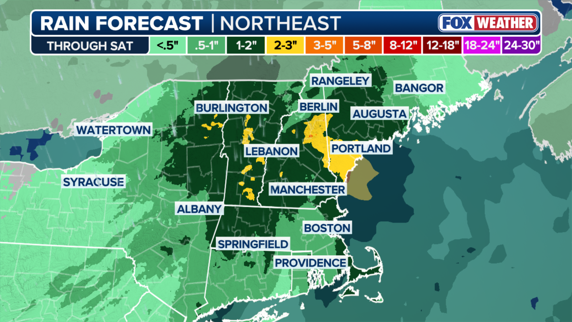
By Friday, showers will linger, but coverage will be limited. From now until then, 1 to 2 inches of rain will be possible across upstate New York and interior portions of New England.
As the prolonged gloom takes hold in the region, let’s take a look at what prediction markets anticipate for rainfall totals in New York City this month.
As the area of low pressure persists in the Northeast, conditions will remain damp and cool – bringing a feeling more akin to early March, rather than late May.


